
::LAT + ::LON
Dashboards: browser · CLI · servers
Community extension: anofox_render
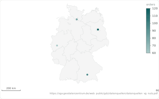
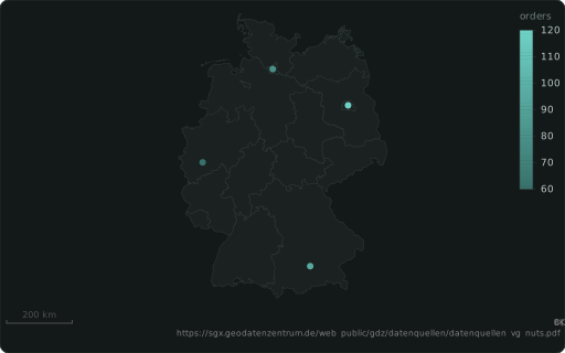
A map point’s latitude (degrees, WGS84), with ::LON. With ::LON: a map point’s longitude (degrees, WGS84), with ::LAT.
Also spelled: ::LATITUDE · ::LON (::LONGITUDE, ::LNG)
The data it needs
Section titled “The data it needs”One row per point: ::LAT and ::LON in degrees (WGS84); a measure colours or sizes (::SIZE) it, ::LABEL names it, ::BASEMAP draws a backdrop.
SELECT lat ::LAT, lon ::LON, city ::LABEL, orders ::BARCHART, 'de-states' ::BASEMAPFROM (VALUES (52.52,13.40,'Berlin',120),(53.55,9.99,'Hamburg',80),(48.14,11.58,'Munich',95),(50.94,6.96,'Cologne',60)) t(lat, lon, city, orders);In an example
Section titled “In an example”From Which chart fits which question? — open it in the builder ↗:
SELECT ST_Y(geom) ::LAT, ST_X(geom) ::LON, mag AS "Magnitude" ::BARCHART, place ::LABEL, 0.6 ::ALPHA, 'world' ::BASEMAP, 'USGS earthquakes (M≥2.5, past 30 days) — colour = magnitude'::TITLEFROM ST_Read('quakes.geojson') WHERE mag IS NOT NULLAlso in: Where do our deliveries and customers cluster, and which regions are underserved?